
Shakopee Previous Residents by Record Era
There is no single Shakopee roll of everyone who lived at an address. The record trail changes by era and by role. A modern parcel can yield a property ID and legal description, while maps and newspapers can help with an older lot or a household question. The era table names the documented Shakopee and Scott County sources without claiming that any one source proves continuous occupancy.
| Source | Years it covers | Where held | What it shows |
|---|---|---|---|
| RecordEASE document, plat, lien, and tract paths | Online historical start not exposed | Scott County Land Records | Recorded instruments and legal-description routes |
| SCHS plat maps | 1854-1974 named series | Scott County Historical Society | Lots, blocks, plats, and changing address context |
| Shakopee Sanborn maps | 1884, 1890, 1895, 1902, 1910, 1935 | Scott County Historical Society | Building footprint and use context |
| Shakopee newspaper microfilm | 1856-2014 | Scott County Historical Society | Dated notices, obituaries, reports, and advertisements |
| Census, church, cemetery, and will records | Varies by collection | SCHS, library, and FamilySearch | Household and relationship leads |
Use the current address for the property step. Use the legal description or historic lot language for the older step. An address matched only by a modern ZIP or map pin needs more confirmation before it is treated as the same historic place.
Start Shakopee Previous Residents With the Parcel
Scott County’s Property Information instructions say to search by house number plus the first few street characters, or use the nine-digit Property ID, but not both. The page defaults to the current payable tax year. Save the PIN, situs address, legal description, plat, lot, block, section-township-range, municipality or tax district, and dated values before moving backward. A parcel is a land reference, not a current household list.
The county result may show property address, city, state, ZIP, property class, legal description, and recorded-document links. The captured Shakopee specimen also shows why geography needs care: a Shakopee situs address and ZIP can appear beside Prior Lake municipal or school fields. Preserve the displayed fields instead of silently treating every label as the same geography.
- PIN
- The nine-digit Property ID used by Scott County to identify a parcel.
- Situs address
- The property’s displayed physical location, which can differ from a mailing or tax label.
- Legal description
- The plat, lot, block, or survey wording used to identify land in recorded material.
Shakopee Previous Residents Through RecordEASE
Scott County Land Records records and maintains deeds, mortgages, assignments, releases, and satisfactions. Its public RecordEASE path includes document search by parcel number or document number, related-document searches, plats or liens, and a tract index for plats, metes-and-bounds descriptions, and condominiums. Public web access requires registration and is subscription based. The archived 2014 fee schedule is not a current price list, so confirm cost with the recorder before ordering anything.
The Scott County plats and liens search is shown below.
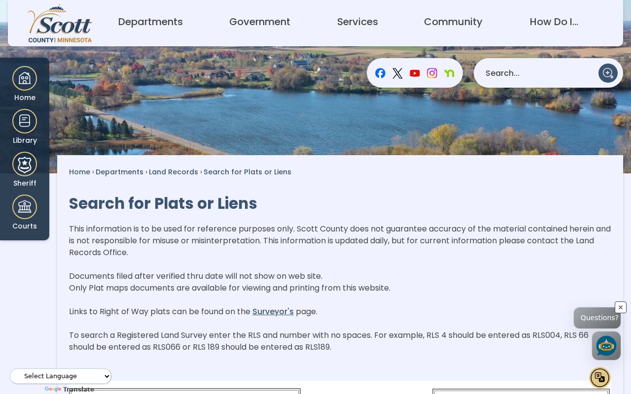
The County says these pages update daily and omit material filed after the stated verified-through date. The plat and lien page also says registered land survey numbers use no spaces, such as RLS004. That notice makes the portal a reference path, not proof that the online result is complete or final.
Follow the Scott County Deed Chain Backward
A chain of title is the sequence of recorded transfers for a parcel. Start with the current parcel and a recent transfer, then use the people and document details in the record to locate the earlier instrument. A grantor transfers an interest. A grantee receives it. Those roles describe a transaction at a date, not a claim that either person lived at the property.
- Search the Scott County parcel by address or nine-digit PIN and copy the legal description.
- Use the parcel number, document number, or related-document function in RecordEASE to locate a recorded transfer.
- Record the document date, document number, grantor, grantee, legal description, and any stated relationship.
- Search the prior transfer using the seller, prior grantee, or legal description, checking that the parcel language still matches.
- When the online path stops, ask Land Records whether a tract index, paper book, microfilm, or in-person search covers the earlier period.
Scott County does not expose a verified online historical cutoff or digitization start in the research reviewed. The careful question is: for this PIN, what is the earliest indexed instrument, what is the verified-through date, and what series covers earlier instruments?
Note: A deed chain can identify ownership transfers without proving which people occupied the Shakopee address.
When a Shakopee Street Was a Lot or Tract
Older Shakopee records may describe a lot, block, rural route, township, post office, or predecessor street name instead of a modern address. SCHS plat maps supply a bridge from the earliest named 1854 map through the 1974 series. RecordEASE’s tract index is the county route for legal descriptions when a current PIN is missing or the history uses metes-and-bounds language. A metes-and-bounds description identifies land through directions and distances, rather than a numbered lot.
No official source reviewed confirmed a full Shakopee street-renumbering, annexation, or former-postal-designation list. Ask SCHS, City Clerk, GIS, or Land Records to verify an asserted old-to-new address match. Do not use a matching modern ZIP as the bridge by itself.
Shakopee Previous Residents in Maps and News
SCHS holds six Shakopee Sanborn snapshots, dated 1884, 1890, 1895, 1902, 1910, and 1935. The maps can show a block’s building footprint and use at a point in time. They do not name every resident. Pair a map sheet with a plat, a dated newspaper item, and a parcel or legal-description note instead of assigning a person to a building from the map alone.
The Scott County Historical Society visit page gives the research-access route shown below.
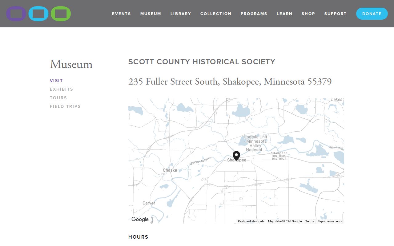
At SCHS, researchers can use the research library and request help by form, visit, or phone. The holdings include Shakopee newspaper microfilm from 1856 through 2014. Cite a newspaper hit by issue title, date, page, exact name, address or organization, and the limited point it supports.
Shakopee Past Households in Historical Collections
Owners are only one part of the record. SCHS lists state and federal census material, church baptism, marriage, and death registers for most county churches, cemetery plot maps, obituary and announcement cards, subject files, and family-history books. Its current census holdings page says 1857-1950, while an older official version said 1857-1920, so confirm the actual run onsite. The Shakopee Directory Book explains how to request an unverified city or address directory volume without inventing a run.
The SCHS cemetery records can offer a burial-location clue. FamilySearch’s Minnesota Will Records displays Scott County coverage of 1857-1970 and may name a testator, spouse, heirs, executor, witnesses, dates, and residence details. These findings can support a family relationship or a dated lead. They do not by themselves establish that a person occupied the address for an entire period.
Lawful use. Use Shakopee house and family history records for personal, lawful research. Do not use a historic address trail to harass, track, expose, or harm a living person.
Label Shakopee Previous Residents by Role
Each Shakopee source identifies a different relationship to a place. Keeping the role beside the name prevents a common error: converting a dated land, tax, burial, or civic record into a claim of residence. Use a small research log for every candidate, especially when names repeat across a family or neighborhood.
| Parcel owner | A person associated with ownership in a parcel record on the displayed date. |
|---|---|
| Grantor or grantee | A party transferring or receiving an interest in a recorded instrument. |
| Taxpayer or mailing label | An administrative association that may differ from the situs address. |
| Household clue | A person named in census, church, obituary, or newspaper material for a documented time. |
| Occupancy | Requires a source that actually states the person lived at the address, with date and context. |
Include the source URL or repository, collection title, date, displayed address or legal description, name spelling, role, page or instrument number, and a confidence note. A missing search result may show an unindexed period, a variant name, a restricted record, or a source that does not cover the question.
Shakopee Previous Residents Beyond the Online Cutoff
When a Shakopee address trail reaches the verified-through boundary or an older legal description, switch from a portal search to a custodian request. Scott County Land Records is at the Government Center, 200 4th Avenue West, Shakopee, and the research file lists 952-496-8150. Ask which tract-index, book, microfilm, or paper series covers the period. State the PIN, legal description, address variants, date range, and whether inspection or copies are preferred.
Scott County also accepts public-data requests under the Minnesota Government Data Practices Act through its Request Data route, responsible authority, or direct office contact. The county identifies electronic delivery, pickup, email, regular mail, fax, and onsite inspection as possible channels. The custodian may estimate costs or remove private data. A precise request is more likely to identify the right Shakopee collection.
Note: Recheck portal notices, repository access, copying rules, and hours before relying on a Shakopee records trip.